 tessera
Plane radar
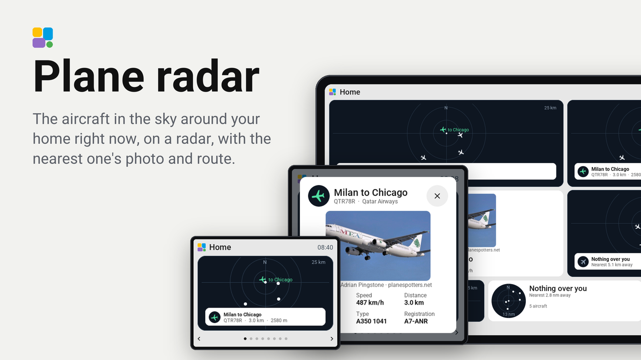
The aircraft in the sky around your home right now, on a radar, with the nearest one's photo and route.
On each screen
| Screen | Rating | Ratings | Homes |
|---|---|---|---|
| Guition 4″ · ESP32-S3-4848S040 | 5.0 ★ | 3 | 3 |
| Guition 7″ · JC1060P470 | Not yet | 0 | 1 |
| Guition 7″ · JC1060P470 V2 | Not yet | 0 | 1 |
| Guition 10.1″ · JC8012P4A1 V3 | Not yet | 0 | 1 |
How these numbers are counted
Everything here is shared by choice from the Tessera app, one per installation of the app, without an account. A like can come from anyone, also from someone who does not run the plugin. A rating comes from someone who has run it on a screen for a few days, and shows from 3 ratings. Homes are the installations that agreed to be counted and said in the last 30 days that they run it.
These are not verified installations or a quality score. Reinstalls and lost keys can affect them, and one home network adds at most two of each to a plugin.
What the app sharesThe aircraft in the sky around your home right now, on a radar, with the nearest one's photo and route.
- A radar that stays dark in the light look and the dark one, with a ring at a third and two thirds of the range, north at the top and your home in the middle. Every aircraft is an airplane turned along its course; the nearest glows, with its name beside it.
- They move. Positions come every 30 seconds, and in between the screen moves each aircraft along its course at its own speed, every second.
- The larger the tile, the more it says. One cell shows the radar and the nearest aircraft. Larger tiles add its route, its distance, altitude and speed, and its photo where there is room.
- A tap opens the sky. The card shows the radar large and a list of the aircraft, nearest first. A tap on one, on the radar or in the list, opens it: its photo, its airline and type, where it flies from and to, and its numbers.
Set up
- Add the plugin to a screen in the Tessera app.
- Put the Plane radar tile on a page.
- It stands at your home (Home Assistant's Home zone) unless you choose another Place in the tile's settings: a zone, or a person or tracker that moves, so the radar goes with them.
- Choose the Range (10, 25 or 50 km) and the Units: metric (km, m, km/h) or aviation (nm, ft, kt).
Where the data comes from
| What | From | Terms |
|---|---|---|
| Positions | adsb.lol, live ADS-B from volunteers' receivers | Open data (ODbL) |
| Photos | planespotters.net | Each photo shows its photographer and planespotters.net |
| Routes and types | adsbdb | Free |
Aircraft on the ground, and an airport's own cars, are left out: the radar shows what flies. An aircraft whose transponder sends no position, as some military ones, does not show. A route is what the airline's flight number usually flies; on a special day it can be another.
What leaves your home
- To adsb.lol, every 30 seconds while a tile shows: your place's position rounded to two decimals, about a kilometre, and the range. Nothing else.
- To planespotters.net and adsbdb, for the aircraft a tile, the card or a popup shows: its transponder code and its flight number. Your place does not go there.
The Tessera app asks these services; the screen itself reaches none of them.